The National Weather Service says impacts will vary throughout the tri-state.
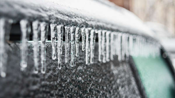
Shutterstock photo.
Update published Wednesday, February 2 at 9:42 a.m.:
The National Weather Service has upgraded a Winter Storm Watch to a Winter Storm Warning.
The updated forecast calls for total snow and sleet accumulations of 1 to 3 inches and ice accumulations of two tenths to one quarter of an inch for portions of southeast Indiana and central and southwest Ohio.
The Winter Storm Warning goes into effect at midnight Wednesday and runs until 7:00 a.m. Friday.
Power outages and tree damage are likely due to ice, and travel could be near impossible. If you must travel keep an extra flashlight, food, and water in your vehicle in case of an emergency.
Counties listed under the Winter Storm Watch include Dearborn and Ripley counties in Indiana, and Hamilton County, Ohio.
Update published Tuesday, February 1 at 11:36 a.m.:
A Winter Storm Watch has been issued for much of the tri-state area.
According to the National Weather Service, the watch goes into effect on Wednesday, February 2 at 9:00 p.m. and runs until Friday, February 4 at 7:00 a.m.
The updated forecast calls for heavy mixed precipitation. Total snow accumulations of 2 to 4 inches and ice accumulations of one quarter to one half of an inch are possible.
The Winter Storm Watch is for portions of Southeast Indiana, Northern Kentucky, and Central, South Central and Southwest Ohio.
The National Weather Service says power outages and tree damage are likely due to ice.
Travel could be nearly impossible in some areas, with hazardous conditions likely to impact the morning and evening commutes Thursday and the morning commute Friday.
Wind chills are also likely to be impactful, falling below zero degrees Friday night.
For more information, visit WWA Summary by Location for 39.1N 84.85W with INZ074/INC029/INZ074 emphasis Winter Storm Watch (weather.gov).
Original story published Monday, January 31:
(Wilmington, Oh.) – A winter storm is expected to bring rain, sleet, and snow to the tri-state area.
According to the National Weather Service, rain, which may be heavy at times, is expected on Wednesday. Rain could turn to freezing rain and sleet on Wednesday night and into Thursday.
Although, the chance for freezing rain and sleet is higher on Thursday afternoon as temperatures drop below freezing. The low on Thursday is 18.
Heavy accumulations of ice are possible, followed by the potential for snow on Thursday night, with some accumulations possible.
The NWS says the exact timing and accumulations of snow and ice are still uncertain.
[4:00 AM] There are still uncertainties regarding the system for midweek, w/ adjustments to the favored axes for heavy snow, mixed wintry precip (including ice), and rain still likely to occur in the coming days. The impacts will vary wildly from one part of the area to another. pic.twitter.com/6CF0vsMAnG
— NWS Wilmington OH (@NWSILN) January 31, 2022
 Ken Maddin to Appear on Wheel of Fortune
 Bridge Deck Overlay Project to Begin on U.S. 52 in Brookville
 Town of Dillsboro Announces Sanitary Sewer Cleaning and Inspection Project
 KSP Charges Carroll County Woman with Child Sexual Exploitation Offenses
 Houchin Introduces Bipartisan Bill to Hold Colleges Accountable for Student Debt
 KYTC to Host Informational Meeting for Potential Improvements to Dixie Highway