Damaging straight-line winds, as well as a few tornadoes, will be possible.
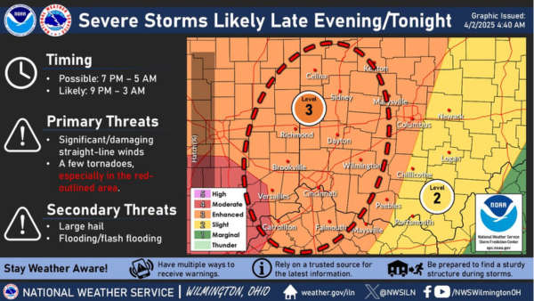
(Tri-State Area) - The National Weather Service is calling for severe storms today. The primary severe threat will evolve late this evening into tonight.
Damaging straight-line winds, as well as a few tornadoes, will be possible. Some large hail and instances of flash flooding are also possible.
A multi-day heavy rain/flooding event is expected to unfold Thursday into early Sunday. Total rainfall through early Sunday may approach 6" in some spots. Some significant flooding, as well as widespread rises on area waterway, can be expected by this weekend.
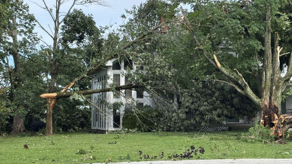
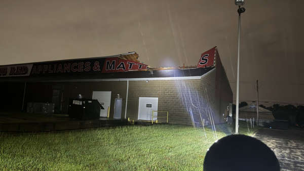 NWS: Tornados Confirmed in Aurora, Franklin Co., Florence, Carroll Co.
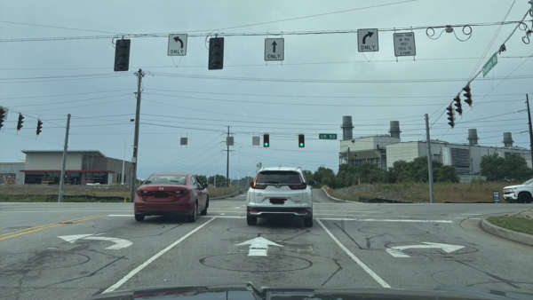 INDOT Makes Changes at Busy Lawrenceburg Intersections
 Water Tie-in Project Impacting Water Pressure for Greendale Residents
 Community Resource Day Connects Families with Local Resources and Summer Fun
 Gov. Braun Declares State of Disaster Emergency for 63 Indiana Counties
 New Trail Opens Connecting Clifty Falls State Park to Madison’s Riverwalk