
More showers are likely Thursday, meteorologists say.
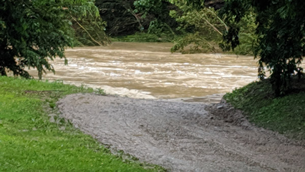
Tanners Creek has been running high in Guilford, Indiana due to recent rainfall. Photo by Mike Perleberg, Eagle Country 99.3.
(Lawrenceburg, Ind.) - How wet have things been this week? Imagine going water skiing in a monsoon.
The National Weather Service says estimates of rainfall this week are at least four inches in most of the tri-state. Some areas are approaching eight inches of rainfall this week, which is typically the amount that falls in about six weeks this time of the year.
A Flash Flood Watch is in effect for the whole tri-state through Thursday evening. Late morning and afternoon showers are likely Thursday, and some of those showers could develop into thunderstorms, according to the weather service.
Despite all the wet weather lately, local rivers are not expected to reach flood stage. Models show the Ohio River at Cincinnati is at 43 feet Thursday morning with a crest of 43.4 feet currently expected to happen Friday. Flood stage there is 52 feet. However, the river level is high enough that it has forced the cancellation of Thursday's Brantley Gilbert concert at Riverbend Music Center.
Although the Great Miami River at Miamitown went above flood stage of 16 feet briefly on Tuesday, it is currently at 13.7 feet with a crest of 15.4 feet expected Thursday night or Friday morning.
The Whitewater River at Brookville has been fluctuating between eight and 12 feet this week. Flood stage is 20 feet.
[640 AM] Yet another day with rain in the forecast. Highest amounts along/north of I-70, much less and scattered amounts near and south of the Ohio River. ANY downpour in ANY location could cause rapid/localized flooding. Flash Flood Watch remains in effect! pic.twitter.com/FlpH3iQMBt
— NWS Wilmington OH (@NWSILN) June 20, 2019
 Dearborn County Indiana Farm Bureau Insurance Welcomes New Agent
 Gabbard Riverfront Park Pavilion Nearing Completion
 Motorcyclist Injured in St. Leon Crash
 Franklin Co. Sheriff’s Office Announces Expansion of Recovery Support Services
 UPDATE: Missing Franklin Co. Teen Found Safe
 INFB Survey: Hoosiers May See Lower Prices Ahead of Fourth of July


Comments
Add a comment