Remember: Turn around. Don't drown.
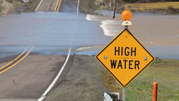
Shutterstock photo.
(Northern Kentucky) - High water is continuing to impact numerous roads in KYTC District 6.
These roads in Boone, Carroll, Gallatin and Kenton counties remain blocked due to flooding as of 9:00 p.m. Monday.
Boone County
- Riddles Run Road (KY 2852) between Beaver Road (KY 338) (0.0 mile point) and Hathaway Road (KY 536) (2.33 mile point)
Carroll County
- KY 389 beginning near Green Bottoms Road to KY 55 (4.48 to 7.23 mile points)
- U.S. 42 from KY 55 (5.57 mile point) to the intersection of US 42/KY 36 (4.52 mile point)
- KY 36 from the intersection of KY 36/US 42 (8.12 mile point) to the Carroll/Trimble County line (0.0 mile point)
- KY 55 between the spilt to KY 389 and KY 549. (3.57 to 5.76 mile points)
- KY 36 from the railroad crossing to KY 47 (21.97 to 23.21 mile points)
- KY 467 between Harrison Street and Buffalo Creek Road (0.50 to 2.0 mile points)
- Goose Creek Road (KY 1204) between KY 227 and Kendall Road (0.0 to 0.45 mile points)
- KY 389 from the Carroll/Henry County line extending to near Camp Branch Road. (0.0 to 1.5 mile point) This portion of KY 389 is now completely covered with water.
- KY 2997 just north of Woodrow Wilson Road (2.51 mile point) to KY 389 (4.25 mile point)
Gallatin County
- Steeles Bottom Road (KY 1992) closure begins near Davis Road (2.0 mile point) extending to 3.9 mile point.
- Craigs Creek Road (KY 1130) between KY 35 and Winn Road (3.7 to 4.7 mile points)
- KY 467 between U.S. 127 in Glencoe and KY 35 in Sparta (2.2 to 7.6 mile points)
- KY 35 just south of Craigs Creek Road (KY 1130) (5.9 to 6.1 mile points)
- U.S. 42 West between Carvers Trail and Knox Lillard Road (4.6 to 5.2 mile points) is expected to close soon due to rising waters.
- No commercial vehicle traffic on KY 1039 extending over the Markland Locks and Dam (6.4 to 7.1) due to flooding in Switzerland County, Indiana.
Kenton County
- Decoursey Pike (KY 177) at Conley Road (7.4 mile point)
- Locust Pike (KY 1930) near Locust Pike Park (1.5 to 2.5 mile point)
- Locust Pike (KY 1930) between Wards Lane (5.94 mile point) and Red Row Lane (5.69 mile point)
- Decoursey Pike (KY 177) near Washboard Road between 3.8 and 4.7 mile points
- River Road (KY 8) between Amsterdam Road (KY 371) (0.01 mile point) and Lagoon Street (3.78 mile ponit)
- KY 14 (Rich Road) between Hempfling Road and Cruise Creek Road (6.4 to 6.8 mile points)
High water remains possible even for roads not listed. Drivers are urged to check GoKY for traffic conditions before traveling. Never drive through a flooded roadway. Remember: Turn around. Don't drown.
KYTC will continue to provide updates as new closures are added and previous closures are cleared. Additional updates between press releases will be posted on the KYTC District 6 Facebook page.
 Versailles Pumpkin Show: A Fall Tradition That Gives Back
 Two Pools of Mosquitos Tested Positive for West Nile Virus in Ohio County
 Silver Alert Issued for Jennings County Woman
 2027 DCF Scholarship Applications Now Available for High School Seniors
 Garbage Truck Fire Reported at Milan High School
 Dearborn County Convention, Visitor & Tourism Bureau Awards Local Tourism Grants